
Thursday, November 20, 2014
Weekly Blog Post 10

Weekly Blog Map 7

Weekly Blog Map 3

I like how they did the writing for the Thames river, making the words overlap like water currents.
Tuesday, November 18, 2014

Tuesday, November 11, 2014

Tuesday, November 4, 2014

Final Project Proposal
Assuming that 1 metric ton of coal is converted to electricity at 40% efficiency, for 2,460 kWh/ton.
Given: http://www.sourcewatch.org/index.php/Existing_U.S._Coal_Plants#State-by-state_output
Given: http://www.sourcewatch.org/index.php/Existing_U.S._Coal_Plants#State-by-state_output
| State | 2005 Power Production (GWh) | 2011 Power Production (GWh) | Change (%) |
|---|---|---|---|
| Alabama | 70,144 | 56,807 | -19% |
| Alaska | 650 | 656 | 1% |
| Arizona | 40,730 | 43,702 | 7% |
| Arkansas | 23,356 | 29,418 | 26% |
| California | 3,024 | 1,982 | -34% |
| Colorado | 35,671 | 33,955 | -5% |
| Connecticut | 3,995 | 526 | -87% |
| Delaware | 5,185 | 1,455 | -72% |
| District of Columbia | - | - | 0% |
| Florida | 66,378 | 51,991 | -22% |
| Georgia | 87,624 | 60,159 | -31% |
| Hawaii | 1,548 | 1,424 | -8% |
| Idaho | 51 | 83 | 63% |
| Illinois | 92,772 | 90,013 | -3% |
| Indiana | 123,985 | 104,153 | -16% |
| Iowa | 34,729 | 38,229 | 10% |
| Kansas | 34,595 | 31,656 | -8% |
| Kentucky | 92,613 | 91,656 | -1% |
| Louisiana | 23,190 | 24,628 | 6% |
| Maine | 754 | 55 | -93% |
| Maryland | 29,782 | 21,059 | -29% |
| Massachusetts | 12,095 | 4,059 | -66% |
| Michigan | 71,871 | 58,948 | -18% |
| Minnesota | 34,336 | 28,259 | -18% |
| Mississippi | 16,661 | 9,723 | -42% |
| Missouri | 77,714 | 78,316 | 1% |
| Montana | 17,844 | 15,056 | -16% |
| Nebraska | 20,175 | 25,965 | 29% |
| Nevada | 18,412 | 5,407 | -71% |
| New Hampshire | 4,097 | 2,208 | -46% |
| New Jersey | 12,090 | 4,155 | -66% |
| New Mexico | 29,990 | 27,141 | -9% |
| New York | 22,018 | 9,426 | -57% |
| North Carolina | 78,854 | 59,758 | -24% |
| North Dakota | 29,813 | 27,109 | -9% |
| Ohio | 137,457 | 105,337 | -23% |
| Oklahoma | 36,446 | 34,479 | -5% |
| Oregon | 3,588 | 3,334 | -7% |
| Pennsylvania | 122,093 | 100,603 | -18% |
| Rhode Island | - | - | 0% |
| South Carolina | 40,545 | 34,169 | -16% |
| South Dakota | 2,999 | 2,586 | -14% |
| Tennessee | 59,264 | 40,777 | -31% |
| Texas | 148,759 | 157,897 | 6% |
| Total | 2,026,184 | 1,733,430 | -14% |
| Utah | 36,008 | 33,138 | -8% |
| Vermont | - | - | 0% |
| Virginia | 35,099 | 19,881 | -43% |
| Washington state | 10,483 | 5,229 | -50% |
| West Virginia | 91,601 | 75,964 | -17% |
| Wisconsin | 41,675 | 39,938 | -4% |
| Wyoming | 43,421 | 40,961 | -6% |
Given: http://www.epa.gov/radiation/tenorm/coalandcoalash.html
| Wastes | Radiation Level [pCi/g] | ||
|---|---|---|---|
| low | average | high | |
| Fly Ash | 2 | 5.8 | 9.7 |
I will use the energy produced, the average weight/energy ratio, and the average radioactivity of fly ash (airborn ash) to determine the gross radiation being put out of coal power plants by state.
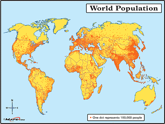
This map is kind of what I'm looking for, but I think I can do a whole lot better.

This map is kind of what I'm looking for, but I think I can do a whole lot better.
This map is more the look that I'm going for, though.

Subscribe to:
Comments (Atom)